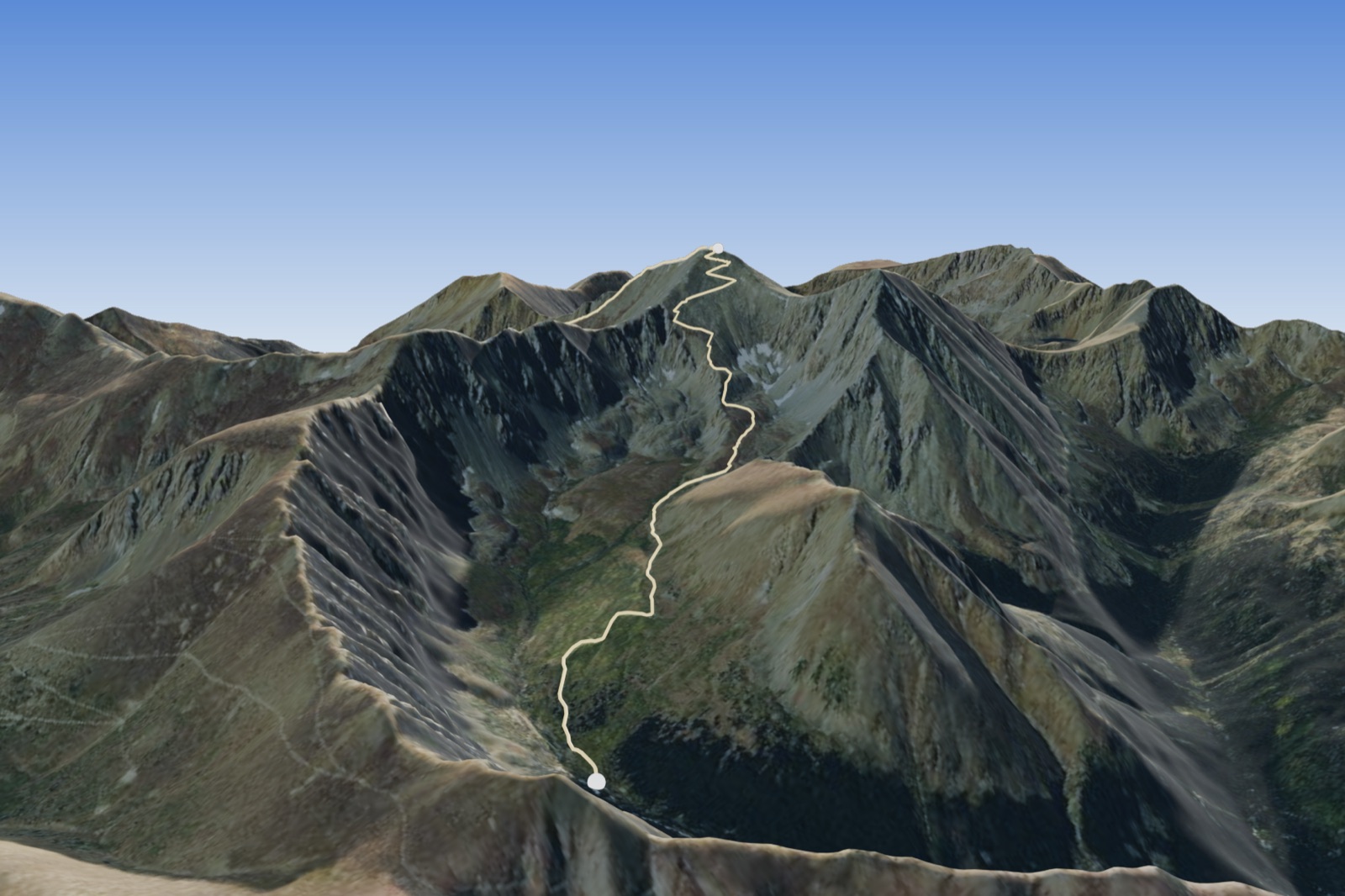
The nearest Class 1 fourteener to Boulder: a walk-up on a built trail from Stevens Gulch, the highest point on the Continental Divide, shared with Torreys next door.
Grays Peak trailhead, 11,280 ft · road: 3 Easy 4WD/AWD, good clearance (14ers.com) · 67.3 road miles from North Boulder. Get here
Standard cars stop at the Bakerville lot off I-70 exit 221 and walk the road, about 6 more miles round trip and about 1,000 ft more gain (14ers.com figures).
Conditions, closures, fees and permits are the land manager's word, not ours. Read them before you drive. Alerts and closures · Arapaho National Forest, Clear Creek Ranger District · Forecast for the summit (NWS)
North Slopes · Class 1 · 3,000 ft gain · 7.5 mi round trip · Exposure Low · Rockfall Low · Route-Finding Low · Commitment Low (figures from 14ers.com, route gray1, updated Jul 2026)
No track file yet. The figures are 14ers.com's; follow their route page.
Food that packs, from the recipes. Tick what you will carry; the bundle keeps the list.
Our practice, until we hold a published sports-nutrition source: carry about 200 to 300 kcal for every hour on the move, plus a real breakfast before the drive. The hours line is a house estimate from the round trip and the gain; your pace decides.
Your day, as one bundle: the guide and your plan together. Nothing is sent anywhere; it lives in this page and in what you print, copy or save.
Peak names, ranges, elevations and positions from Wikipedia, List of Colorado fourteeners (CC BY-SA 4.0). Route class, gain, round trip and the updated month are figures from each route page on 14ers.com, which holds the route descriptions; read the page before you go. Trailhead positions from 14ers.com; Directions opens Google Maps with the trailhead as the destination and nothing else set; Map opens OpenStreetMap (ODbL). Conditions, closures and permits are the land manager's word, not ours.
Class definitions from Wikipedia, Yosemite Decimal System (CC BY-SA 4.0), read 2026-11-05 (mountaineering library C-35); the route class on each card is 14ers.com's. The choosing lines rest on the mountaineering library, grown 2026-11-05: the afternoon storm as the day's clock (C-21, NWS Boulder), the class ladder (C-35), gain and distance read together (C-26, C-32); altitude rules C-11 to C-18 are on each peak's page. Not personalised advice.
 asharedpalate.com